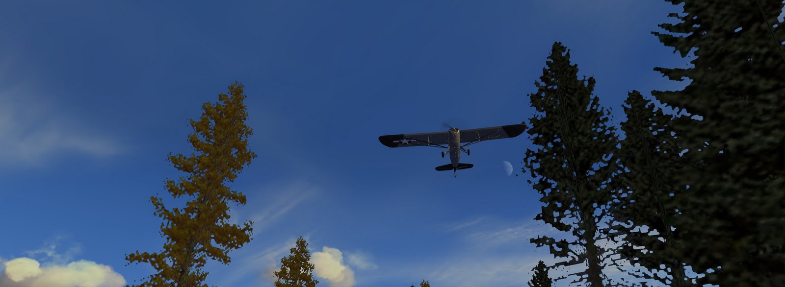
Sunday, September 11, 2011

St. Louis

Changed my mind about touch-and-go practice, at least for now. I know how to land properly, my problem last time was just not preparing for the landing early enough. I slowed down some, but basically just "winged it" and thus was trying to control too many variables at once. For a good landing, you need to get the plane trimmed out to the proper landing speed early and get at the right altitude and on the right traffic pattern so you minimize the number of things you're having to do during the landing itself.

Anyway, I decided instead to fly north to St. Louis for some sight-seeing. It didn't look too far on the map, although I should have checked to see exactly how far it was. Turns out it was around 100 miles! I took off and established a cruising speed of 124 knots, which somehow (in spite of no apparent tail wind) translated into a ground speed of nearly 140 knots. Still trying to figure that one out. After 45 minutes, I made it and got some nice views of the arch and downtown area:
(click to enlarge)

After a couple of flyby's (but no gratuitous fly-through's), I used by GPS to get some information about an airport just on the other side of the river (in Illinois) and just a bit south of the arch. It's called St. Louis Downtown Airport (KCPS). The GPS had the runway information, elevation, radio frequencies, etc. Very cool!

I called in and got clearance to land, slowed down, entered the pattern and prepared for landing and actually landed pretty good, although still off-center. The only real problem was that I landed on the wrong runway! I had clearing to land on 30R (runway 30, right), but landed on 30L by mistake. The airport had two parallel runways, and I was so focused on making a good landing that I forgot about that and just landed on the nearest one. I wonder how much trouble that would get me in? None in FSX, fortunately.

Later, I took back off, did another fly-around of the city and headed south. I thought about switching to a smaller plane, like the Champ, and trying to fly through the arch, but that would have just been silly. The return trip was uneventful and as I got closer to my destination I went overboard with pre-landing preparedness. I descended and slowed down much earlier than necessary, adding a few minutes to my journey, but by the time I was in the pattern, I was trimmed out at 70 knots and had gone through my landing procedure in my mind several times. This landing was perfect, right on target, right down the middle, nice and soft with the nose up just a bit, etc.

I wish I had a picture of it, but after the landing and after checking the flight analysis (to log the time and distance, etc.), when I went back to do a replay of the landing FSX got one of those fatal errors and crashed out on me again. Grrrrr! I wonder if I added my system RAM if that would fix the problem?

Saturday, September 10, 2011

Headin' to Missourri

So, there's this new plane I've been meaning to buy. It's called a Rockwell Commander, built by Rockwell back in the 70's, after which they sold the design to Gulfstream who sold it to someone else, etc., etc. Currently the rights are owned by Commander Premier Aircraft Company, located at Cape Girardeau Regional Airport, in Missourri, south of St. Louis. CPAC, as it's called, is owned by a group of Commander owners and provides support, spare parts, etc., but has fallen on hard times such that its plan to start building new Commanders has thus far not worked out so well.

Of course, the Commander I want to buy is the FSX version, made by Carenado (same company that made my Skylane), but I thought it would be neat to fly out to Cape Girardeau just the same. Once I download the Commander, I can fly it back to Dalton.

This was going to be a longer trip than usual, and actually turned out to be my longest flight yet at two hours and thirty eight minutes (previous record was two hours and ten minutes). It's 325 nautical miles from Dalton to Cape Girardeau as the crow (or Skylane) flies, so I decided to study my GPS a bit more:
I haven't learned all the in's-and-out's, but I can select an airport to fly to and then use the GPS to determine my course and stay on it. The purple line running up through the middle of the screen is the desired route, so you just have to fly along it to stay on course. The unit tells you the distance to the airport (in nautical miles), your speed over the ground (in knots), and your ETA plus other info. You can actually program in way points with turns to go around areas you don't want to fly over, but I just did a straight point-to-point route as that was easiest.

I also relearned the Skylane's autopilot. Once I got to altitude (6500 feet), I trimmed out for level flight and then used the autopilot to hold a steady heading (based on what the GPS was telling me). At that point, all I had to do was monitor the aircraft (engine, etc.), keep a look out for other planes and just enjoy the ride.

My route took me through Tennessee and then over the boundary between Kentucky, Illinois, and Missourri, at which point I noticed this bridge:
(click to enlarge)

It's the Cairo Ohio River Bridge, which according to BridgeHunter.com is a "Cantilevered through truss" bridge over the Oio River on US 51/60 between Cairo, Illinois and Wickliffe, Kentucky.

I also crossed paths with a couple of other small planes during the trip. Still climbing out of Dalton, I contacted Chattanooga and requested a "flight following" where they assigned you a transponder "squawk" code and track you by radar during your flight. Along the route you get handed off from one control area to another and they alert you to other air traffic that's near you. Near Nashville, I had a Beechcraft cross my path heading south, but he was a good 2500 feet below me.

A bit further on, I was running into some turbulance at 6500' and decended to 5500', which was a mistake. I had forgotten the rules about altitude. If you're heading west, as I was, you fly at an even-thousand foot plus five-hundred, so 2500, 4500, 6500, etc. Flying east, you maintain an odd-thousand foot plus five-hundred (3500, 5500, etc.). North/South traffic stays on even/odd thousands without the five-hundred. That way, the only planes at your altitude should be going basically the same direction you're going, so risk of collision is minimized.

Well, at 5500' I noticed a speck headed my way several miles out. About that time, the air traffic controller alerted us to each other's presence. The other plane was a Maule Orion (see my Darthe Maule post from last month). We ended up passing with a couple of miles between us, but at a closing speed of over 250 knots, so it was still pretty exciting. Had I been at the correct altitude, we would have had 1000' altitude difference so it would not have been as dramatic.

Anyway, I continued my flight and finally made it to Cape Girardeau. I was pretty tired, so unfortunately my landing was pretty sloppy. No excuse, that's just what happened. I didn't trim my plane down to the right speed, so I ended up coming in fast and shallow and when I flared, I ballooned up and then came down on all three wheels at once, and way off center on a runway that's 150' wide! I was embarrassed and don't plan to let that happen again.
After the landing I did manage to taxi back to the parking area and shut down. This airport has a major highway next to it, so I was able to see the ground traffic from the ground, and at a closer range than normal:
(click to enlarge)

As penance for my sloppiness, I'm going to do some touch and go practice in the Skylane this weekend and delay the Commander purchase a bit longer. When I feel that I've earned it, I'll get the new plane and show it off in my next post.

Monday, September 5, 2011

Prater's Mill Flight Park - Runway of the Insane!

Spent most of the day flying. Came back from Huntsville and landed back in the rain. Switched to the Tomahawk for some rainy touch-and-go practice, and then for something completely different, I turned off the rain, switched to the Champ and decided to check out the Prater's Mill Flight Park. It's a little grass runway north of Dalton that's used by very small planes including RC Model planes as well.

I've never been there in real life, but if it's anything like modeled in FSX, the pilots who use it must be completely mad. It's basically a rectangular field completely surrounded on all side by trees. The Champ has a pretty short takeoff capability, but I still found myself pulling up hard, almost to the point of stalling, and still having to dodge trees on the way out. This made me question whether it was even possible to land here.

I made several attempts, most of which required me to abort and go around for another try. On one attempt, I got on the ground and tried to brake to a stop before I got into the trees but couldn't stop. I even tried swerving between the trees to miss them, but with nearly twenty foot of wing sticking out on either side, that proved impossible as well.

On a later attempt though, I was finally able to land successfully, but this has to be the most dangerous landing approach I've ever tried. Here's the cockpit view approaching the field:
(click to enlarge)

Hard to see the field because of the trees. If I clear all the trees, I'm too high and don't touch down until near the far end (by which time I'm into those trees and tearing my wings off again). Instead, I found this gap and I'm going to have to go between those trees, below tree top level, to land on this end of the field. Here's another view of the approach, a little closer, and from outside the plane:

(click to enlarge)

In this next shot, I'm down "in the weeds" so to speak, below tree-top level, trying to make it through with both wings intact. Almost there:
(click to enlarge)

As I get closer, I passed between these two trees, the larger green one on the left and the smaller yellow one on the right. Recall that the Champ has a 35' wingspan, so at most, these trees appear to be 45-50' apart. It looks like I'm actually brushing the leaves with my left wingtip:
(click to enlarge)

Here's a ground-level view of the same gap. Should have moved a few feet to my right. Definitely touching leaves on the left:
(click to enlarge)

However, I could not have moved much to the right. For one, I only had ten or maybe fifteen feet clearance on that side to the yellow tree, but those weren't the last trees I had to dodge. The next shot is from a couple of seconds later, as I pass another tree pretty close. This time I miss the leaves on my right side by maybe five feet:
(click to enlarge)

But I missed all of the trees and managed to get my wheels down at about the mid-point of the runway, and managed to brake to a stop just off the end of the official runway (hard to see, but the grass is actually mowed where the runway is supposed to be!):
(click to enlarge)

That's quite enough of that! Short field landing practice is good, but this airstrip is just crazy. In real life, I'm pretty sure the trees aren't that big or that close to the runway.

(update - found a web site for this place, http://pratermillflightpark.com. It looks a little more open and from the description, should have plenty more room than what's modeled in FSX. Perhaps the pilots who use this place aren't so crazy after all. Maybe it's just me!)

Rainy Day Flight to Huntsville

Very rainy day in Dalton, so after a couple of short flights around town I decided to trade up to the beefier Skylane and head over to Huntsville to visit my sister. I took off in the rain, but was quickly above it. Not much to look at during the flight, just cloud-tops, but I'm relearning VOR navigation and I also figured out how to use the GPS.

Some newer planes have GPS built into the panel, but the ones I fly, if they have it at all, it's more like the GPS you buy for your car with the suction cup that attaches it to the windshield. I haven't figured out any advanced features, but I was able to turn it on, zoom in and out, and use it to figure out where I was in relation to the airport I was heading towards.

As a backup, I had also tuned in a VOR about 5 miles from the airport, and was using that as a rough guide and for range. Between the two, I was able to fly straight to the airport, even with no view of the ground from altitude, and only limited visibility once I got down closer to the ground.

It was not actually raining where I landed, and the landing went smoothly. I taxied in to the fueling area and noticed something odd:
See the windsock back there opposite my plane? Seems like in between two buildings is not a great place to put that. Should be closer to the runway, where it might actually prove useful.

Anyway, I may do some more flights around Huntsville and experiment with the GPS more. Still raining here in Dalton, so not much else to do.

Saturday, September 3, 2011

Airport Tour of North Georgia

Last night I decided to take a little tour in the Skyhawk. I wanted to check out some of the other reasonable sized airports in the area. None of those sidewalk sized runways, but real airports.

I started by flying from Dalton down to Carter's lake, then over towards Gilmer County. Along the way, I did another flyby of the tower thing:

(click to enlarge)

I still can't figure out what it is. Nor can I locate anything like it in the area using Google Earth. I wonder if there's a forum somewhere for FSX users to identify odd stuff like this?

From there, I landed at Gilmer County Airport, 1486 ft. above sea-level, with a smaller runway than Dalton, but not too small (3500' long, 75' wide).

I did a touch-and-go landing and then headed south to Pickens County. That airport is more like Dalton's, 5000' runway and 100' wide, but like Gilmer, it's more in the mountains (1,535' elevation). Another touch-and-go, then due west to Tom B. David airport in Calhoun. That was an interesting landing. About the time I announced my position and intent to land, another small plane (Piper Cherokee, I think), announced its intent to land on the same runway. It was a couple of miles closer, so I swung wide south of the airport to give him time to land.

As I passed the airport, I was able to look out my left window and spot the Piper flying the pattern. I had to zoom in to see more than just a smudge moving along parallel to the runway. Then, by the time I had swung around and was about to turn into the pattern myself, I got another view of him on final approach and landing.

Calhoun is actually a little bigger than Dalton, 6000' long and 100' wide, and slightly lower at 647 feet elevation. I did another touch-and-go, then headed northwest towards Barwick/Lafayette airport but with a slight sight-seeing detour:
(click to enlarge)

The mountain range in front of me is called "The Pocket" because of how the ridge comes south, turns and then heads back north. I've ridden my bike through this area a number of times (including a tough climb over the ridge), and have spent a weekend here with my Daughter at the Girl Scout Camp. There's actually a small lake (large pond?) in there, but it was not modeled in FSX.

After flying down into and back out of The Pocket, and resumed my northwest track and started looking for the last airport. The pocket runs north/south, so I should have just turned due west instead. I ended up almost missing the airport on the north side, but sorted things out, turned south and did one final touch-and-go. Barwick/Lafayette is 5350' long, 75' wide and at an elevation of 777' above sea-level.

My tour almost complete, I turned back due East and returned to Dalton. Total flight time ended up being one hour and twenty-five minutes, with five total landings.

Friday, September 2, 2011

Skyhawk Touch-and-Go

Back in Dalton, I decided to switch planes again. I had called out to the Dalton Airport earlier in the week out of curiosity and found out that they use a Cessna 172 Skyhawk for training, which is not unusual since it's the most popular training aircraft in the world. Anyway, I hadn't flow the Skyhawk in a while (not since I purchased the larger more powerful Skylane), so I took the Microsoft "used trainer" version out for a few laps around the airport.
(click to enlarge)

On the ground, the plane was really tough to taxi around in. I kept over-correcting left and right and just zig-zagging around. Other planes don't seem to have that problem. Not sure if the Skyhawk is really that over-sensitive or just the FSX version.

In the air though, the plane handled nicely. I would take off with one notch of flaps, climb out a 75 knots or so until I hit 1000 feet (runway is a bit over 700 feet), then I'd retract the flaps and turn around, climbing to about 1500 feet and up to 80-100 knots. Then I'd level off, slow back down, extend one and then later two notches of flaps and trim out for about 75 knots for the landing approach.

Finally, about a mile down-range, I'd turn back around and reduce power to start descending to land. After landing, I'd retract back to one notch of flaps, power up and start the process all over again.

All three landings were good. None went long and all were pretty close to center, but none perfect (yet). The last one was tricky because my youngest son was literally climbing on my back while I was trying to land. I think it was the best though (see photo above).

Thursday, September 1, 2011

Return to Dalton

Long day today and long evening back home. Wife working late, me with the kids, school project due tomorrow. Yikes! By 9:30 though, everyone but me was in bed, so here I am flying again.

First observation, if you fly on August 31st, it's summer time and the trees are green. Fly on September 1st, and it's fall, so the trees are yellow, etc. No transition, just BAM!

On the way back home from Cherokee (and back in the Tomahawk), I decided to give that tower thing another pass. I'd really like to know what that sucker is:
(click to enlarge)

I mean, it's out there in the middle of nowhere, just this huge tower with some kind of crane like attachment. What is it for? I've searched around Google maps and have not found anything like that out in the woods in that area. Please add a comment if you have any ideas:
(click to enlarge)

Anyway, after the fly-by I climbed back to altitude and cruised back to Dalton for a nice landing. All of that practice seems to be paying off:
OK, so I'm still not landing right on the white center-line, but I'm getting closer!

Oh, by the way, I was checking my log book and realized that one of those practice landings back at Mathis was actually my 100th successful landing. Woo Hoo!