Wednesday, August 31, 2011

Goodbye Mathis!

OK, just one more flight for the month. I did four more practice landings at Mathis Airfield using the Champ. I think I finally figured out the secret. Even when I skimmed low over the trees and then tried to drop down over the lake at the last minute, I ended up having a hard time getting the plane to land. When I'd pull back to flare, she'd just float over the runway, which isn't long enough for you to do much of that.

By my ninth total landing attempt at this airfield, I had figured out a few things. 1 - The Champ's altimeter is none too accurate, and not adjustable like the fancier ones on larger planes. I was assuming it was accurate, when it was reading a little high. 2 - The stall speed of the Champ is just under 40 knots (38, I think), and I've been trying to land at a comfortable 55-60 knots, but on a short field like this, I had to trim the plane out to land at 50 knots or less, which gives very little margin of error against stalls. When flaring, you'd hit right at 40 knots or so over the runway, which is dicey, but necessary. 3 - Rather than come in low and shallow, flying slower allowed me to come in steeper, with a higher rate of descent, which kept the floating to a minimum and helped me stick the plane to the runway.

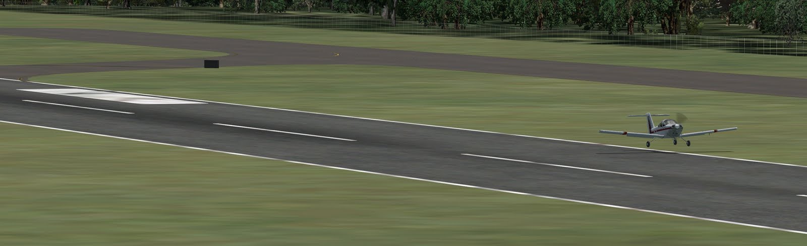
Here's final shot of my last landing as I come in over the end of the runway, low and lined up correctly:
After that landing, I turned around, took back off and headed back to Cherokee County Airport to pick up my Tomahawk. Flight was uneventful (it's only 15-20 miles between airports), but as you may recall from an earlier post, there's an oddly large tree right at the end of the Cherokee runway, just to the right of center:
(click to enlarge for a better view)

I've been struggling with still photos to illustrate just how close I have to get to these trees some time, but I think I've found a way. In this photo you can see the large tree to my right and can see that the top of the tree if higher than I am. You can also see the four white landing lights to the left of the runway indicating I'm actually too high in my approach at this point. Any lower and I'd be looking up at the tree!
Here's a second view, same moment in time (replay paused), but from a directly overhead view:
Recall that the Champ's wingspan is only 35', so you can see that at this point, the tree is only about 20' from the nearest wing tip, and as I move forward, I'll pass within maybe 10' at my closest approach. They really need to cut that tree down!

Anyway, once clear of the tree, I shifted over to the right to line up with the runway. Here I am crossing the threshold not too high and centered up nicely (see shadow). I did not land perfectly on the center line, but I was not far off. Definitely better than in previous landings due to the practice I've had at Mathis.

Mathis Landing Practice

Back home and back to Mathis Airfield for some serious landing practice. I took back off in the Champ towards the cliff, circled the airport and came back in for landing number one. Trees seemed scary close on approach, but I was probably no lower than on prior attempts. I overshot the start of the runway and touched down about a third of the way down, on the asphalt at least! I then powered back up for a touch-and-go, but perhaps that was not such a good idea. I was facing the tree filled end of the runway and even with the short take-off capabilities of the champ, I barely cleared the trees:
I'm actually starting to bank to the right just a bit in that image, hoping to get my left wing up above to the top of that tree. Anyway, the next attempt wasn't much better, but at least I did a full stop landing and stopped before the end of the runway.

The third and final attempt before I had to take a break was the best so far. I really was down in the trees on the approach:
Hard to tell from the pictures, but when you pause the replay and pan around you can tell how tight everything is. There's a tree to my left that is taller than my current wing level, and other trees that are right around and just barely under me. Too much lower, and I probably would hit something. At about the point shown or a little before, I killed all power and basically dove through a gap in the trees to try to lose another couple hundred feet over the water so I could grab the end of the runway (but without crashing into the cliff face):
This is probably as good as I could hope for. I've cleared the cliff, lined up on the runway, and I'm only 30' or so in the air at this point. I got the wheels down and braked to a stop at about the midpoint of the runway:
Hard to tell from this image, but the runway is narrower than my wing span, and only about twice the width of my main gear. The Mathis website says it's 35' wide, but that may be a recent improvement. The Champ has a 35' wingspan and the wings clearly extend off on either side over grass. I'd say the runway as simulated in FSX, is only about 20' wide. It feels like landing on a sidewalk!

Anyway, daddy duty calls, so that's probably all the flying I'll get in tonight. August has been a busy month. Looking forward to September.

Champ at Mathis

Since I've worked late the last two nights, I decided to go in a bit late this morning so I could stay home (after the kids were off to school) and fly a little. I was irritated by my failed landing at Mathis, the little tiny airport that I tried to fly into with too much plane, so I switched to the Aeronca Champ and flew from Cherokee (where I had last landed), over to Mathis, about 15-20 miles to the south-east. Here I am flying the pattern downwind. Click to zoom and you'll see the cliff right at the end of the runway!
My first approach was too high, so trying to be more sensible than last time, I powered up and aborted that one. The next time I turned onto the base leg and final too soon and was off to the right and too close to adjust, so I flew the pattern one more time. On the third try I was lined back up correctly, so I headed in low and slow. To have any shot at all of making this landing, you have to be right at tree top level as you approach from the far side of the lake:
Here's another view of how low I was coming in. That tree on the left is higher than my wing and not far from me. I couldn't have gotten much lower than this without hitting something, but I still ended up too high! Next time, I'm going to need to clip the tops of the trees and then nose down and dive over the lake to lose about another 100' so I can actually touch down on this end of the runway:
Since I didn't know to do that, I overshot the end of the runway and ended up touching down at about it's midpoint. I was also fighting a cross-wind and trying to stay lined up on a runway that's narrower than my own wingspan! Recall that the whole runway is only 1800 feet, so by the time my left wheel touched down (see next photo), I only had about 900 feet left:When that wheel hit, I bounced up and over and ended up putting both wheels down in the grass. I got on the brakes pretty quick and tried to steer back on the runway, narrowly missing this sign as the taxiway comes in from my left:
I finally got her stopped just off the end of the runway, back in the grass:
In the previous flight, this is where I continued to roll until my little Tomahawk ran into those trees down the hill.

I think I'm going to stay here in Mathis with the Champ for a while and do some more landing practice. If I can land on this postage stamp of a runway reliably, then landing at larger airports like Dalton, where the runway is three times as long and three times as wide should be a piece of cake!

Sunday, August 28, 2011

One More Time...

Not wanting to end the day on a sour note, I started over in Dalton, but this time decided to fly to the Cherokee County Airport, which is a bit closer, and which is a larger airport. I did my research, or thought I did, determining that the runway was 75 feet wide x 5011 feet long, so just a bit shorter than Dalton, and at an elevation of 677 feet, a little lower than Dalton. I would take off, head south-east to Carter's Lake and continue south-east until I found the airport, about twice as far from Carter's Lake as Dalton. As I passed the lake, I noticed this odd feature. Looks like a river that ends in a culdesac with an island in the middle:
From looking at Google maps, I think it's actually a hairpin turn in the river but the river gets smaller at that point and FSX stops modeling it, so it just seems to end.

It took 6 minutes to get from Dalton to Carter's Lake, so another 12 minutes or so past that and I found Cherokee County. I circled the airport and determined two things. First, the airport was not at 677 feet, but at over 1000 feet, and second, the runway was at a different heading than I expected. Hmmmm? Anyway, the sun was going down so I flew the pattern and turned on final approach:
Another nice sunset shot. As I lined up on the runway, I noticed something else. There's a big bunch of rather tall trees right at the end of the runway! They are just off to the right of center though, so I lined up to the left of the runway and just slipped over after I had cleared the trees. (oh, and that's I-575 on the left):
Landing was pretty good, although I was a bit left of center. That was not due to any cross wind. In fact, if anything the cross wind should have pushed me to the right a bit. The problem was having to dodge around those trees. I'm pretty sure they are not like that at the real airport.
Anyway, after landing and recording the flight details, I went back to look at the Cherokee County Airport to see why I had my elevation and other information wrong. Turns out I was looking at Cherokee County Airport in Jacksonville, Texas! D'oh!

The Cherokee County Airport in Georgia is at 1219 feet elevation and the runway is only 3414 feet long. Long enough, but not as long as I thought. So as an addendum to the "do your homework" rule, make sure you do your homework correctly!

I'm hanging it up for the night now. I think tomorrow I may take the little Champ down to that Mathis airport though and see if I can land it on that little strip.

Trees Hurt!

Should have quit while I was ahead, but after taking a break to take the boys for ice cream, I decided to fly down towards Atlanta and try to land at a little airport near where a friend of mine lives. It's Mathis Airfield, a little private airport in Cumming, or maybe it's in Suwanee.

Took off from Dalton OK, and managed to find the airport:
One end of the runway is right over a cliff above a small lake, and there are trees all around the place. Plus it's clearly a lot smaller than Dalton, so I should have (1) done more research before the flight, or (2) aborted and found a larger airport nearby.

Instead, I circled the airport once to get a feel for it, then attempted to land. On the first try, I came in too high and knew I couldn't get on the runway so I powered up and aborted that attempt. Should have learned something from that, but instead I circled for another try.

My second attempt seemed about right, coming in to the end of the runway, narrowly seemed to miss some trees on the approach, but then when I tried to flare to land I floated a bit and before I knew it I was half-way down the strip. I should have aborted again, but I was tired and ready to be done with the flight so I jammed the plane down on the runway and stomped on the brakes.

Landing at about 70 knots though, it takes a while to stop. Apparently it takes a little more room to stop than what I had as I went off the end of the runway, through the grass, down a little hill and into some trees! Ouch!

One thing that really irks me about FSX is that after a crash it just reloads the flight, back to where you started (in this case, Dalton). There's no opportunity to review the flight, do an instant replay of the landing (such as it was) or really learn anything from it.

Sure, I learned the generally lessons (plan ahead and know when to land somewhere else), but I'd like to have rerun the landing and crash to see just how bad it was (and to get some pictures).

(update - did some post-crash research. Mathis has a runway that's 1800 feet long by 35 feet wide. Dalton is 5,496 feet long (3 times the length) and 100 feet wide (total area of concrete is about 10 times as large!). Since I normally use a third to a half of the runway at Dalton, it's no wonder I couldn't stay on this one. Maybe if I touched down perfectly at the very start of the runway, but not otherwise. Lesson learned.)

More Touch & Go

Beautiful day today. Back at the airport flying with real weather again. This time there was a 13 knot wind from 355 degrees. Runway is at 320 degrees, so direction of wind was 35 degrees off-center. Not a full cross wind, but still something to contend with. Plus the wind was stronger today than yesterday and with gusts up to 16 knots.
I flew seven pretty consistent patterns, with just a couple of wide turns on the base leg/final approach and had seven not bad landings (none on the grass) but none perfect. The picture above is of my fourth out of seven and probably the best. I'm just a bit to the right of center-line, but otherwise pretty good.

I had one short landing, on the runway but behind the white markers, four long ones, generally from flaring too soon and floating (killing instead of just slowing my rate of descent), and two that were right on the money, one a little right and one a little more left of center.

No grass on my wheels this time at least, but I still need to work on it.

Saturday, August 27, 2011

Touch and Go in Dalton

After a 40 mile bike ride this morning which wore me out more than expected, I decided to take a sit-down break and do some touch-and-go landing practice. That's basically where you take off, fly around the airport, land, but then go back to full throttle to take back off and do it all over again. I loaded up the Tomahawk at the Dalton Airport, current time (around noon) and real-world weather, which seemed nice out.

My first attempt was not so great. I had trouble lining up, and in fighting that I overshot the ideal touchdown point (see that big white area behind me), and still only got two wheels on the runway:
After landing, I eased back onto the runway, lined up on the center-line, and went back to full throttle. With this small plane, and Dalton's runway having been extended to handle small jets, I was back in the air before the mid-point of the runway.

Next time around was much better. I eased around for the final approach, nice smooth curve instead of sharper turns with corrections, and seemed to be on track for a perfect landing, but by the time my wheel's touched down, I was off to the left again. At least I landed on the threshold properly and had all three wheels on concrete, but I would like to have been on the line:
The third go-round was the worst of the bunch and really frustrating. I tried to do a smooth easy turn, but overshot and then over corrected and back and forth until I finally went long again and landed full in the grass:
Fourth time was a charm though. Not perfect (sill of to the left a bit), but nice and smooth, right on the threshold and all wheels on runway:
After reviewing the flight (images are captured in replay mode as it's hard to take external shots when you're trying to land), I figured out what was wrong. I have been flying mostly at night, but with the simulator set to daytime and "fair weather" which means no wind. Since this was a Saturday, and I could fly during the day, I used the current time and real weather (downloaded from the internet). That real weather included a 7 knot wind which was almost perpendicular to the runway. In other words, a mild cross wind.

I noticed that there was a 7 knot wind, but did not think to look at direction or account for that on my landing approach. I figured 7 knots is not very fast so not a problem. Had it been a stronger cross wind, I probably would have figured out the problem after the first landing attempt, but it was so subtle, I thought it was just something I was doing to not line up right, or perhaps I was not compensating for the Tomahawk's natural tendency to turn left a bit (due to the torque of the engine - propeller spins to the right).

Lesson learned - always listen to the weather radio and note the direction and speed of the wind before landing!

Thursday, August 25, 2011

Mystery Crane

Kids in bed, time to fly some more. Switched back to the Piper Tomahawk planning for a quick evening flight over to Fort Mountain and back. After flying over the mountain though, I turned south and saw a strange object in the distance.

After flying over and circling the thing, I'm still not sure what it is:
It's some kind of crane or something, but just out there in the woods off Highway 76 (between 411, south of Chatsworth, and Ellijay). This area is mostly wilderness, so maybe this is part of some kind of logging operation or something. Hard to say.

It's just north of Carter's Lake, so I finished the flight with a low run over the lake. As before, I felt like my tires were going to get wet, but after reviewing the flight data, I was never less than about 180' over the water. I did discover though that there are actually two lakes, one at about 1000' above sea level, and the other at about 750' or so, with a dam between them. I flew over the dam at about 1200' and then dove down to about 950' or so over the lower section, then climbed back up to about 1700' and turned back to the airport. Total flight time, 32 minutes.

(update: for some reason this picture, unlike my other recent uploads, got shrunk down so you can't click on it to see a larger view. But trust me, there's a weird crane thing down there out my window)

Darthe Maule

Not much time to fly tonight, but I was double-checking my airplane inventory and noticed a plane that comes with FSX that I had not noticed before. It's a bush plane (designed for "rough" landing conditions, unpaved runways, etc.) called the Maule Orion. It looked interesting, so I gave it a try:
It's a high-wing tail-dragger, with lots of power (164 mph top speed), and lots of windows for good visibility.
Although as with all high-wing aircraft, visibility in the direction of a turn is blocked by the wing, which stinks when you're turning towards the airport on final approach.

I didn't care for this plane much, but maybe I should have studied it a bit more before just jumping in and taking her up for a flight. The controls seemed too sensitive or twitchy, and the landing was pretty dicey. On replay, it looks like I landed on the left front wheel first, then the tail-wheel, and then finally got the right front on the ground before rolling off the runway into the grass. Not pretty!

Wednesday, August 24, 2011

Tennessee River Gorge Run

Took the Tomahawk out for its first extended flight last night and had a blast. I flew back up to Chattanooga, thinking of just another city sight-seeing trip, but got up there and decided to do something a little different.

Just west of the city, and down river a bit, is the Tennessee River Gorge, sometimes called the Grand Canyon of the South (although I must say, it's far less Grand than the one they have out West). I've been through the gorge on a boat though, and it is fairly impressive, by local standards.

I descended to about 1000' above sea-level and lined up with the river at Moccasin Bend. Click on the image below for a larger version. I started where the arrow points in the lower-right corner and headed down river. The start of the canyons is labeled as is Nickajack Lake, where I ended my run:
For most of the run, I held my altitude at about 800', thinking the river was around 700-750', when it's actually more like 650' up near Chattanooga and closer to 600' by the time you get to the lake. As I mentioned in my previous post though, it SEEMS like you're a lot closer to the water than you are. Here's a view from the cockpit in one of the bends of the river:
A bit further down I realized why you might not want to fly this route in real life. You can see a power line tower on the left bank. There's another on the right, but the wires are not modeled in FSX, so I did not hit them:
This was an evening flight, so the sun started to set towards the end and FSX does have some nice sunset (lens flare) effects. In this image I'm turning into a sharp turn in the river, towards the sunset:

Further down, the river opened out on Nickajack Lake. I-24 crosses the lake and I've driven that many times going to visit my sister in Huntsville. You can also see a road going up the mountain on the left side of this image. I rode my bike up that climb as part of the 3-State/3-Mountain Challenge, a 100 mile bike ride that starts and ends in Chattanooga and climbs three mountains in three states (Suck Creek Mountain, TN, Sand Mountain, AL, and Lookout Mountain, GA). The road shown here was a good climb, but not one of the three mountains, more of a bonus I guess:

After leaving the lake, I climbed to 4000' and headed back to Dalton. On the way I passed the Raccoon Mountain Reservoir on my left. It's an artificial lake on top of Raccoon Mountain that supplies Chattanooga with water. They pump water out of the river up the hill to keep it full. You can also see part of the gorge run that I had just come through in this image:
The flight back to Dalton was uneventful, although it started to get dark to the point I could make out some stars and I also started seeing other airplanes' running lights off in the distance. I circled the airport and made one of my best landings of all time.

This Piper Tomahawk is a fun plane to fly. The FSX model is not as visually appealing as some other planes I've bought, as it seems to have been a Flight Simulator 9 plane that was just tweaked or updated a bit to work in FSX. The Skylane is better looking, but I sure like flying this Tomahawk!

Tuesday, August 23, 2011

Flight of the Tomahawk

Picked up a new plane for the simulator. It's a little two-seat (side-by-side) trainer, the Piper PA-38 Tomahawk. It's smaller and simpler than the Cessna, but more advanced that the Champ - a good in-between plane to train on and a low-wing to boot:
The low wing is great for visibility in a turn, but not so great for sight-seeing, or trying to look down in level flight to navigate visually. The plane handled pretty well in the two short flights I've made around the airport.

I'm still having some computer issues though. No control resets this time, but I installed a sound card (Sound Blaster Audigy SE) to replace the on-board sound that came with the motherboard. That solved the poppling and crackling issue, but the sound coming out of the card seems to have an echo or something going on and is distorted. I've tried some fixes, but without success. I've since e-mailed Creative Labs tech support for help, waiting for a reply.

Sunday, August 21, 2011

Lake Ocoee

Another great day for flying. I spent Friday afternoon with some friends up at Lake Ocoee and then took the wife and youngest two kids up Saturday afternoon. I've got a friend whose family owns a little cabin on the lake with a dock, pontoon boat and Jetski. Having spent two days enjoying the lake in real life, I thought I'd fly over it in FSX to see it from the air.

I chose the Aeronca Champ as it's a good low-and-slow plane for this sort of sight-seeing, and because the Lake is not that far from Dalton, so the Champ's slow cruising speed (about 70 knots) wouldn't be too much of a problem. Here's my cockpit view approaching the south end of the lake:
The large mountain on the other side of the lake is Chilhowee. I use to do a good bit of mountain biking up there back in the day. My first flyover of the lake was rather high, probably 200-250' over the water. I flew up the section you see above, turned right at the mountain, and flew east along that part of the lake, then climbed out and banked hard around for another pass:
During the second fly-over, I got down lower. I'm probably about 100' off the water in this picture:
It's really hard to judge distances visually though in a flight simulator. The extra screens I've added help, and higher resolution would help more, but it's just not "real" enough so everything seems closer than it is. I would have guessed I was about 50' off the water during the flight. I didn't check on-line to get the lake's altitude (about 840' above sea level) until after the flight, so at the time I just knew my altitude above sea level and had to guess at the Lake's.

After the second fly-over, I crossed over the dam itself, which is not modeled in FSX. In the image below, the straight line section of the lake right under my wheels is the dam, but as you can see, there's not even a river coming out on this side:
My friends cabin was just around the corner to the right of the dam (left side of the airplane). We swam within sight of the dam on Friday and Saturday.

Sightseeing over, I climbed back up to about 2500' and headed south-south-west back to Dalton. My approach and initial landing were pretty good:
But then I had another one of those control reset issues. I had set the toe brakes on the rudder pedals to work as brakes, but they occasionally want to reset to their default control, which is to control the ailerons for some reason. After touch-down, I hit the left toe brake a bit trying to straighten out on the runway and accidentally banked the plane left, lifting the right wheel back off the ground:
You'd have to click on this picture to get a better view of it, but the wheel is definitely off the ground. Doesn't look too dramatic from here, but it caused me to veer left pretty hard after I got her level again and I ended up half on the grass before the landing was over.

I've really got to devote some research time to figuring out that glitch and fixing it - before it gets me virtually killed!

Saturday, August 20, 2011

Sight Seeing over Chattanooga

Ah, Saturday morning and nothing to do but fly (got the yard work done through the week!). After my "crash" last time, I decided to try the Chattanooga flight again but not switch out of the cockpit view. I've not solved the problem, but switching views seems to trigger the error. Here's my (wide screen) view out the cockpit approaching the Tennesse River, about where my last flight ended:
Before turning the south and following the river into town, I glanced to the north to check out the Watts Bar Nuclear Plant:

If you zoom in on this image you can see it out my passenger side window. You can also look at the instruments and see I'm flying at about 2900 feet (about 2000 feet above ground-level).

Heading south we come to the end of the lake and the dam. Again, you have to zoom in to see it, but there's boat traffic on the lake and cars moving across the top of the dam and the highway on either side:

Passing the dam, I discovered a little glitch in the program. In this image you can see that the elevation change between the lake and the river below the dam does not line up with the dam itself, but occurs a little down stream:


As usual. you may have to zoom in on the image to make that out. Also, you should be able to see Watts Bar up-river.

A bit further down, I took this picture of the three bridges in downtown Chattanooga. The one to the left crosses over a little island, that's actually a bird sanctuary (but seems to have houses on it in FSX). The middle bridge is the Walnut Street Bridge, build in 1890 and the now (allegedly) the world's longest pedestrian bridge. The Chattanooga Aquarium should be between the middle and right bridges, but there's no sign of it in FSX (and this is with scenery maxed out, so it's just not there):

Just a bit further down, I took this shot of me over Moccasin Bend, a hairpin turn in the Tennessee River just south of downtown. Lookout Mountain is straight ahead, but after flying over I saw no signs of the Incline Railway, Rock City, or any other local landmarks.

Final shot of the trip shows I-24 snaking up over Missionary Ridge. The roads and mountains at least are modeled accurately. From here I followed I-24 back to I-75 and then I-75 south back to Dalton.

There was some heavy fog at the start of the flight (using real-world weather), but that obviously cleared up by the time I started taking photos. Otherwise, the only problem I had was that some of the controls seemed to reset and start doing other functions during the flight. Particularly, I had mapped the eyepoint movement commands (basically what moves your virtual head around the cockpit) to the buttons on the yoke, but mid-flight when I tried to raise my view higher to see over the "hood", I found the button no longer worked but rather caused a pop-up dialog to appear to adjust some setting or another. I tried using the same command straight from the keyboard and got the same result, so it's not a yoke programming issue, it's that the keystroke got reassigned within FSX during the flight. Not sure how that's possible, but I'll look into it. At least FSX didn't freeze up on me before I could get back on the ground!

Wednesday, August 17, 2011

Fatal Error!

Not mine, fortunately. But frustrating. I was making my first real venture outside of Dalton airspace, just a quick hop up to Chattanooga:
(with the new setup, screen captures are REALLY wide - downtown Chattanooga is off to the left as I'm approaching the Tennessee River)

Anyway, as I made my turn to follow the river south, I switched to an overhead view to get a better idea of where I was and FSX froze up, then Windows 7 gave me this Fatal Error message and the option to restart FSX.

That's never happened before, so I have to assume it's some issue with the new monitor setup and Eyefinity. Needs research and a fix because that really stinks!

Tuesday, August 16, 2011

Control Issues

Couple of not so quick flights tonight, working on two issues. First was getting my controls set correctly. I finally got the toe brakes (on the rudder pedals) to work as they should, but I'm having other issues. I keep making changes to the button assignments on the yoke, but then one or two buttons will not behave as expected in game. Right now it's the elevator trim buttons which want to move my eyepoint position around instead.

I've also been using the actual pre-flight and take-off checklist for the Cessna 182 and rather than just loading with the plane on the runway ready to go, I'm trying to actually go through the proper steps to start the engine, check the gauges, etc. It's boring, but I'd like to learn that part of it. It would be a lot easier, and more interesting, in a real cockpit though. The FSX virtual cockpit has some clickable controls, but it's still not like being there, and some stuff you almost have to use keyboard commands to do, so that takes something away from the process as well.

Still just doing take-offs and landings here in Dalton; still enjoying the super-wide-screen view. Maybe soon I'll actually try to fly somewhere!

Wednesday, August 10, 2011

Video Upload Attempt #1

OK, so here goes nothing. This is just a raw video file from an iPhone, no editing or anything, and since the upload limit (and my internet speed) keep me from sending anything long, this is just the final 30 seconds of a landing - nothing fancy. Also, with only me in the room, I had to stand back for a good view, and so I could not change the view from cockpit, to exterior, etc. But this still gives you an idea:
I probably should have cleaned up my desk a bit first. What a mess! Next time it will be neater, I promise!

Back after another long absence...

Just started flying again this month and I've now installed a significant upgrade to my system. When I built this new computer earlier this year I used a Radeon 6850 video card which supports "Eyefinity" a system that lets you run multiple monitors like they are one big monitor. See below:

Originally I just bought the one screen in the middle due to budget constraints, but now I've added two identical screens to the setup. I also had to buy a Display Port to DVI adapter to run one of those screens (they don't tell you that when they sell you the video card), and had to tweak FSX a bit, including a change to one of the .CFG files that had to be done manually.

But it works! As you can see from the still image, I'm landing with the normal forward view, but now with peripheral vision as well. It's amazing how much better the experience is and how much easier it is to land when you can more accurately judge your speed, altitude, etc. due to the added visibility.

The still image does not do this justice though. I've made a short video that I'm going to attempt to upload in the next post. We'll see how this works...